
Smoke Forecast for Thursday, August 7, 2025, 11:30 AM
Current Conditions
A couple of active fires in Idaho will continue to transport smoke into Montana on Thursday.
The Lightning Creek fire, which started last Wednesday just east of Sandpoint, Idaho, has grown to 2,417 acres. It is 0% contained. The fire grew rapidly over the weekend and into the beginning of the week. It has sent a plume of smoke into parts of Lincoln and Flathead Counties. The Big Bear and Rush fires continue to burn in the Bitterroot Range of central Idaho, just southwest of the Bitterroot Valley. The Big Bear fire has grown to 14,935 acres and is 50% contained, while the Rush fire is up to 7,392 acres and is 90% contained. Recent precipitation, cooler temperatures, and higher humidity continue to limit smoke production on these blazes.
At 11:30 AM Thursday, Broadus, Great Falls, Libby, and Sleeping Giant's air quality is Moderate.
By Thursday afternoon, the HRRR smoke model shows limited surface smoke from multiple fires drifting into Montana. However, the impacts today will be limited to the southwestern and eastern portions of the state.
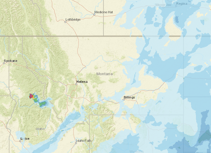
Source: HRRR-smoke
Forecast
Smoke models continue to show the Lightning Creek fire, burning just east of Sandpoint, Idaho, remaining active again on Thursday. It may send some smoke into northwest Montana, particularly Lincoln and Flathead Counties. However, given the lack of transport winds in that area today, impacts should be far less than those in days past. A new weather system moving into the Idaho panhandle should help mitigate fire activity, with more showers and cool temperatures arriving today into tomorrow.
A low-pressure system will move through Idaho today, slowly pushing a cold front through north-central Idaho and western Montana. We are expecting some stronger showers from this storm system that should aid in the containment and suppression of the Big Bear and Lightning Creek fires burning just across the border from Montana in Idaho. Communities downwind of these fires, like the Bitterroot Valley and northwest Montana, may still see some light surface smoke impacts from this pattern.
The low-pressure system moving into western Montana today will bring cooler temperatures and some precipitation. The expected storms could bring moderate to heavy rainfall, small hail, and lightning. Gusty winds are not expected to be a widespread issue, but a few of the stronger storms might produce wind gusts up to 45 mph. Widespread showers are likely to develop across northwest Montana. Temperatures today will stay cool, running about 10 to 15 degrees below normal for early August.
By Friday, the low will start to move out of the Northern Rockies, but it will still bring wrap-around moisture, especially to northwest Montana and areas near Glacier National Park. There is still some uncertainty in how much rain will fall across northwest Montana, but most models are trending wetter, so chances have increased near the Continental Divide. Snow levels could drop to around 8,000 feet Friday morning, and if skies clear overnight, it could be quite cold at night with potential for high mountain valleys to dip into the 30s. The combination of cooler air and precipitation should help moderate fire behavior and reduce smoke production on regional blazes. Thankfully, fuel moistures remain anomalously wet throughout the state, except for portions of southwest Montana, which are closer to average. This will tend to limit new fire starts and slow the spread of existing wildfires. Stay tuned!
Conditions can change quickly as weather could stimulate active fires and the likelihood of new starts increases. Please keep track of concentrations at todaysair.mtdeq.us or the Fire and Smoke Map.
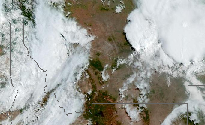
Source: NOAA
| Incident Name | State | Location | Acres | Containment |
|---|---|---|---|---|
| Island Creek | Idaho | Near Sob Point on the Moose Creek Ranger District. | 517 | NA |
| Lightning Creek Fire | Idaho | 9 miles north of Clark Fork, ID | 2417 | 0% |
| Cedar Fire | Idaho | approximately 4 miles northeast of Clyde | 732 | 22% |
| Dominic Point Fire | Montana | NA | 31 | 90% |
| Kinkaid Creek | Washington | 8 Miles N of Nespelem, WA | 261 | 15% |
| Castle Rock Fire | Washington | 6 Miles SE of Colville, WA | 58 | 30% |
| Bear Gulch Fire | Washington | 10 Miles Northwest of Hoodsport, WA | 5136 | 3% |
| Pomas Fire 2025 | Washington | Approximately 36 miles northwest of Entiat, WA | 3468 | NA |
| Bear Creek II | Washington | NA | NA | NA |
Tags: Smoke Forecast 2025