
Smoke Forecast for Tuesday, August 5, 2025, 11:30 AM
Current Conditions
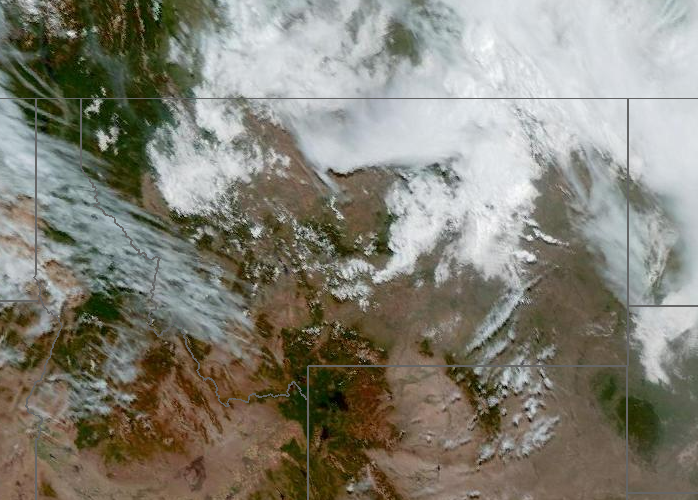
A couple of active fires in Idaho will continue to transport smoke into western Montana at times on Tuesday.
The Lightning Creek fire, which started last Wednesday just east of Sandpoint, Idaho, has grown to 1,900 acres. It is 0% contained. The fire grew rapidly over the weekend and into the beginning of the week. It has sent a plume of smoke into parts of Lincoln and Flathead Counties. The Big Bear and Rush fires continue to burn in the Bitterroot Range of central Idaho, just southwest of the Bitterroot Valley. The Big Bear fire has grown to 14,935 acres and is 50% contained, while the Rush fire is up to 7,382 acres and is 90% contained. Recent precipitation, cooler temperatures, and higher humidity continue to limit smoke production on these blazes.
At 11:00 AM Tuesday, Libby, Flathead, Great Falls, Seeley Lake, Broadus, and Sidney’s air quality is Moderate.
By Tuesday afternoon, the HRRR smoke model shows surface smoke from the multiple Idaho fires drifting into western Montana.
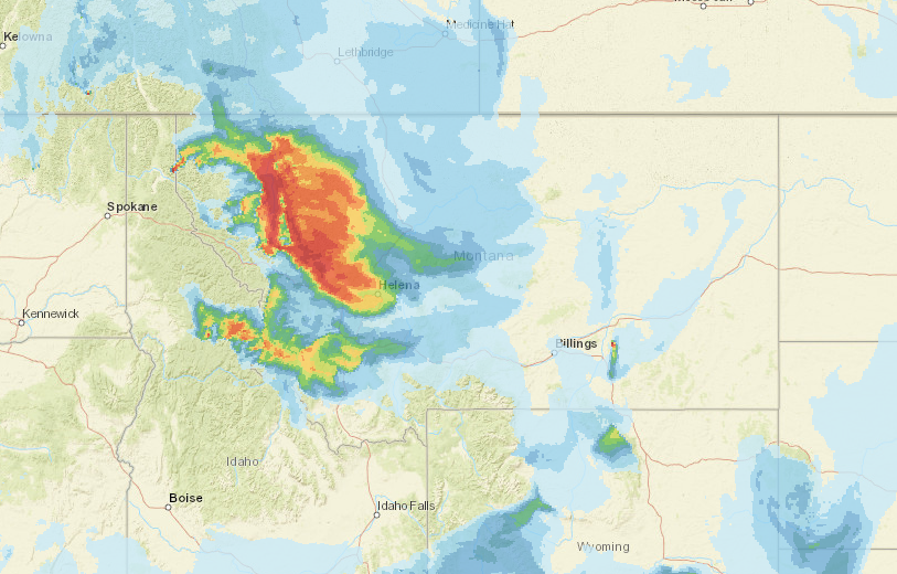
Source: HRRR-smoke
Forecast
Smoke models continue to show the Lightning Creek fire, burning just east of Sandpoint, Idaho, remaining active again on Tuesday. It will send smoke into northwest Montana, particularly Lincoln and Flathead Counties. Weather patterns stabilize today and tomorrow, with more showers and cool temperatures expected towards the end of the week.
A zonal flow developed across the Treasure State today and Wednesday. It will allow afternoon highs to slowly moderate. The gradual warm-up and gusty afternoon winds will lead to more active fire behavior and increased smoke production on the Big Bear and Lightning Creek fires burning just across the border from Montana in Idaho. Communities downwind of these fires, like the Bitterroot Valley and northwest Montana, could see an uptick in surface smoke from this pattern.
The broad trough across the region starts to get narrower today as a ridge builds into the southernmost portions of Alaska and British Columbia. That in turn drives low pressure system directly over central Idaho and western Montana. Current model forecasts have the low center arriving over the region on Thursday. In the meantime, we get a break from thunderstorms today, then later in the week they return.
A trough will march across the Northern Rockies starting Thursday and into the weekend. It will be accompanied by gusty winds and widespread precipitation. Temperatures should cool significantly, and afternoon temperatures will be 10 to 20 degrees below average. The combination of cooler air and precipitation should help moderate fire behavior and reduce smoke production on regional blazes. Thankfully, fuel moistures remain anomalously wet throughout the state, except for portions of southwest Montana, which are closer to average. This will tend to limit new fire starts and slow the spread of existing wildfires. Stay tuned!
Conditions can change quickly as weather could stimulate active fires and the likelihood of new starts increases. Please keep track of concentrations at todaysair.mtdeq.us or the Fire and Smoke Map.
Source: NOAA
| Incident Name | State | Location | Acres | Containment |
|---|---|---|---|---|
| Lightning Creek Fire | Idaho | 8 miles east-northeast of Hope, ID | 1900 | 0% |
| Island Creek | Idaho | Near Sob Point on the Moose Creek Ranger District. | 150 | NA |
| Big Bear | Idaho | 59 Miles NE of McCall, Idaho - Frank Church-River of No Return Wilderness | 14935 | 50% |
| Rush | Idaho | 57 Miles NW of McCall, Idaho - Frank Church-River of No Return Wilderness | 7392 | 90% |
| Cedar Fire | Idaho | approximately 4 miles northeast of Clyde | 536 | 0% |
| Dominic Point Fire | Montana | NA | 31 | 53% |
| Castle Rock Fire | Washington | 6 Miles SE of Colville, WA | 58 | 20% |
| Bear Gulch Fire | Washington | 10 Miles Northwest of Hoodsport, WA | 4936 | 3% |
| Kinkaid Creek Complex Fire | Washington | 8 Miles N of Nespelem, WA | 313 | 18% |
| Pomas Fire 2025 | Washington | Approximately 36 miles northwest of Entiat, WA | 3465 | NA |
| Hope Fire | Washington | Approximately 15 Miles north of Kettle Falls, WA and 5 miles southwest of Northport, WA | 8177 | 95% |
Tags: Smoke Forecast 2025