
Smoke Forecast for Monday, July 28, 2025 10:00 AM
Current Conditions
Weekend thunderstorms led to 10 new lightning starts across the Bitterroot National Forest in Montana where fuel moistures, compared to the rest of the state, were conducive to wildfire growth.
The Observation Point fire burning just outside Hamilton is up to 105 acres and is now 25% contained. Firefighters are getting a better handle on the Deer fire burning just southeast of Missoula. It has burned 75 acres and is 90% contained. The Big Bear and Rush fires burning in the Bitterroot Range of central Idaho, just southwest of the Bitterroot Valley, exhibited active fire behavior at times over the weekend. The Big Bear fire has grown to 11,241 acres while the Rush fire is up to 7,185 acres.
At 9:00 AM Monday, Great Falls' air quality is Moderate.
By late Tuesday night, the HRRR smoke model shows some light surface smoke over northeast Montana from Canadian wildfires.
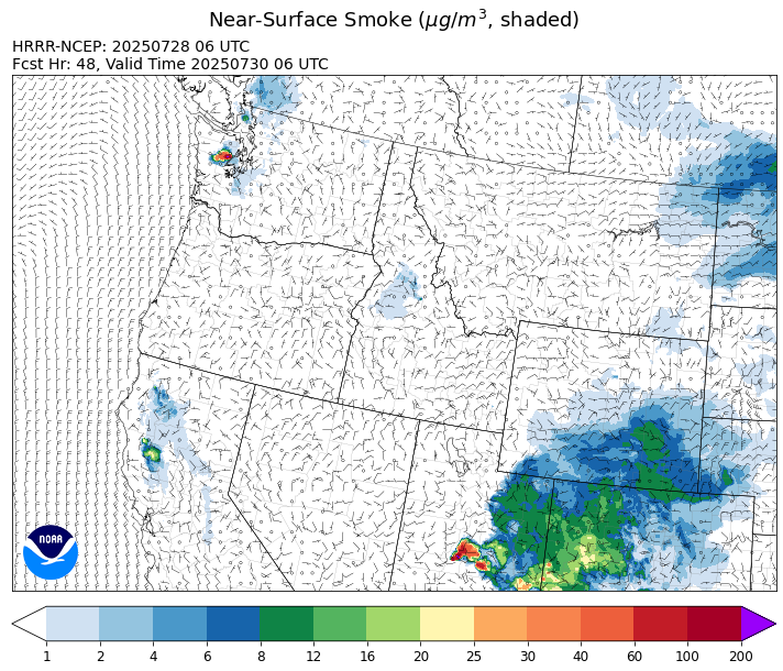
Source: HRRR-smoke
Forecast
Anomalously moist air will continue to funnel north into the Treasure State to start the week thanks to an area of high pressure over the Four Corners and low pressure in the northeast Pacific. This moisture combined with seasonably warm air will be enough to kick off afternoon and evening thunderstorms. As is typical with summer convection, not everyone will receive a thunderstorm, but those that do could see a tremendous amount of rain.
This pattern will continue for the next several days as weak disturbances eject off the low spinning in the Gulf of Alaska. Monsoonal energy will stream north into the state, enhancing rainfall rates with any thunderstorms. The precipitation should help to moderate fire behavior on existing blazes while reducing smoke production. By late Tuesday, easterly winds could bring some minor smoke impacts to northeast Montana from Canadian wildfires.
The pattern shouldn’t change much as the week progresses. Forecast models show convection peaking over the state on Thursday. If verified, this would bring the best chances for widespread precipitation to the area. This regime should continue to keep regional wildfires in check while maintaining anomalously wet fuel moistures across the state. Stay tuned!
Conditions can change quickly as weather could stimulate active fires and the likelihood of new starts increases. Please keep track of concentrations at todaysair.mtdeq.us or the Fire and Smoke Map.
Monday morning’s satellite shows a few thunderstorms over eastern Montana behind a departing area of low pressure.
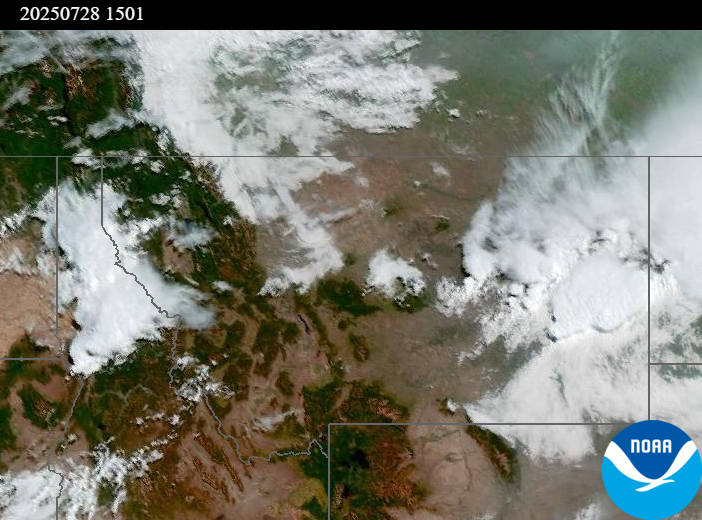
Source: NOAA
| Incident Name | State | Location | Acres | Containment |
|---|---|---|---|---|
| Rush | Idaho | 57 Miles NW of McCall, Idaho - Frank Church-River of No Return Wilderness | 7185 | NA |
| Big Bear | Idaho | 59 Miles NE of McCall, Idaho - Frank Church-River of No Return Wilderness | 11241 | NA |
| Deer Fire | Montana | NA | 75 | 90% |
| Observation Point Fire | Montana, United States | Lost Horse Canyon, 10.5 miles south of Hamilton, MT | 105 | 25% |
| Butte Creek | Oregon | 2 miles west of Simnasho, Oregon | 2079 | 85% |
| Pomas Fire 2025 | Washington | Approximately 36 miles northwest of Entiat, WA | 3449 | NA |
| Hope Fire | Washington | Approximately 15 Miles north of Kettle Falls, WA and 5 miles southwest of Northport, WA | 8157 | 79% |
| Bear Gulch Fire | Washington | 10 Miles Northwest of Hoodsport, WA | 1005 | 10% |
| Burdoin Fire | Washington | 2.5 miles east of White Salmon | 11289 | 54% |
| Lake Spokane Fire | Washington | 12 Miles NW of Spokane, WA | 2550 | 52% |
Tags: Smoke Forecast 2025