
Smoke Forecast for Thursday, July 24, 2025 9:30 AM
Current Conditions
A warm and drier pattern continues to take shape across the Northern Rockies. Regional wildfires will become more active as smoke production increases.
The Deer fire burning just southeast of Missoula has burned 75 acres and is 40% contained. Smoke production and fire activity increased Wednesday on the Big Bear and Rush fires burning in the Bitterroot Range of central Idaho, just southwest of the Bitterroot Valley. The Big Bear fire has grown to 8,955 acres and the Rush fire is up to 6,791 acres. Firefighters have begun to get a better handle on the Cram fire burning near Madras, Oregon. It has burned through 95,736 acres and is now 77% contained.
At 9:00 AM Thursday, Great Falls and Sidney’s air quality is Moderate.
By Friday afternoon, the HRRR smoke model shows some light surface smoke over southwest Montana from wildfires burning over central Idaho.
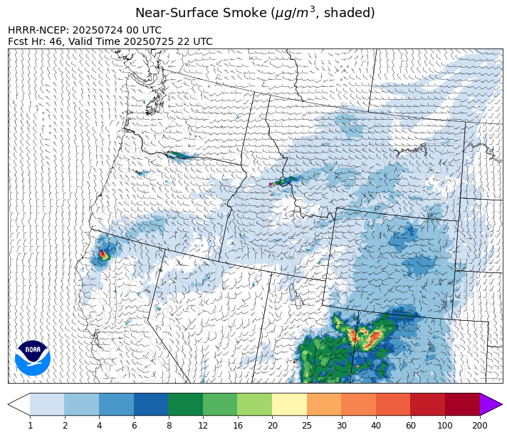
Source: HRRR-smoke
Forecast
A zonal pattern will continue to produce sunny and seasonably warm conditions over the state again on Thursday. Fire activity on the Big Bear and Rush fires increased on Wednesday in response to the warmer conditions. Expect some smoke to drift into southern Ravalli and Beaverhead Counties at times, with minor impacts anticipated to air quality. Air quality will continue to gradually improve across northeast Montana on Thursday as Canadian wildfire smoke decreases thanks to southerly winds.
Friday will be the warmest day of the next week. It will lead to an uptick in smoke production on regional wildfires. A weak disturbance will be enough to kick off a few showers and thunderstorms, particularly across the southern half of the state, but much of the area will remain dry.
By this weekend, a moist southwesterly flow will set-up across the state. It will result in scattered showers and thunderstorms. This pattern should continue into much of the following week. Apart from parts of southwest Montana, fuel moistures across the state are unusually wet for late July. The weather pattern through early August will continue this trend, reducing the potential for large wildfires on the landscape. Stay tuned!
Conditions can change quickly as weather could stimulate active fires and the likelihood of new starts increases. Please keep track of concentrations at todaysair.mtdeq.us or the Fire and Smoke Map.
Thursday morning’s webcam in Comertown, Montana in the northeast corner of the state, reveals fog and some smoke from Canadian wildfires.
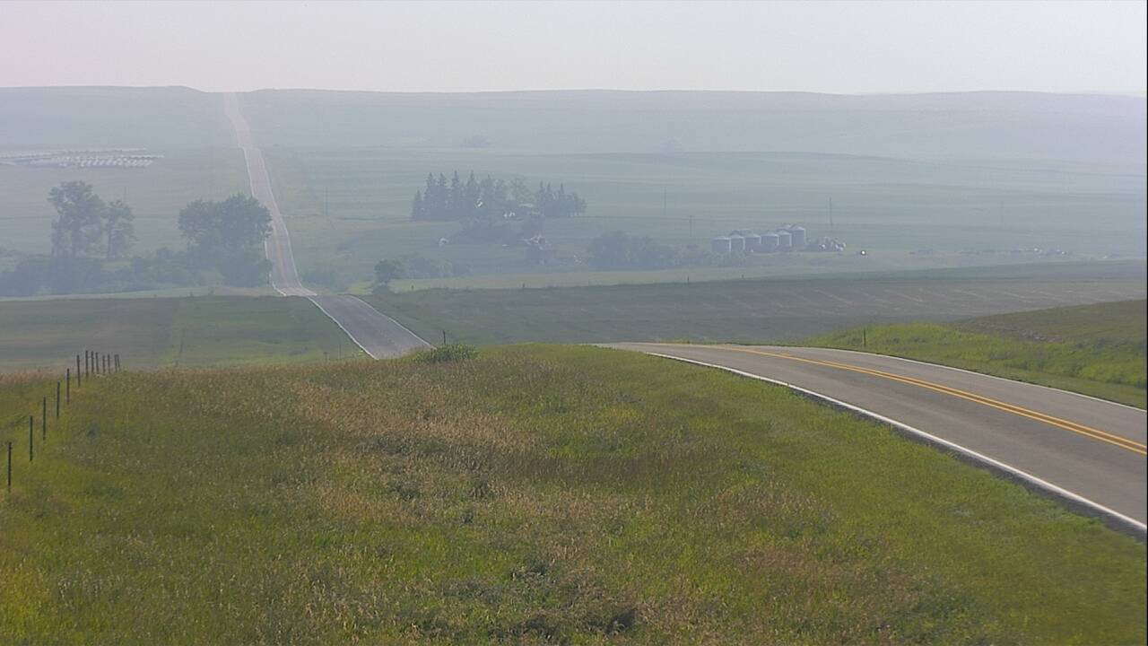
Source: MDOT
| Incident Name | State | Location | Acres | Containment |
|---|---|---|---|---|
| Rush | Idaho | Frank Church-River of No Return Wilderness | 6791 | NA |
| Big Bear | Idaho | Frank Church-River of No Return Wilderness | 8955 | NA |
| Deer Fire | Montana | NA | 75 | 40% |
| Butte Creek | Oregon | 2 miles west of Simnasho, Oregon | 2050 | 30% |
| Cram Fire | Oregon | 15 miles northeast of Madras, OR | 95736 | 77% |
| Hagelstein Fire | Oregon | 14 miles north of Klamath Falls, Oregon | 669 | 75% |
| Elk Fire | Oregon | 7 miles SW of Beatty, Oregon | 2637 | 95% |
| Lake Spokane Fire | Washington | 12 Miles NW of Spokane, WA | 2462 | 16% |
| Pomas Fire | Washington | Approximately 36 miles northwest of Entiat, WA | 3444 | NA |
| Hope Fire | Washington | Approximately 15 Miles north of Kettle Falls, WA and 5 miles southwest of Northport, WA | 7891 | 65% |
| Bear Gulch Fire | Washington | 10 Miles NW of Hoodsport, WA | 799 | 19% |
| Burdoin Fire | Washington | 2.5 miles east of White Salmon | 11160 | 13% |
Tags: Smoke Forecast 2025