
Smoke Forecast for Tuesday, July 21 2026 9:30 AM
Current Conditions
Numerous wildfires across Oregon and Washington continue to burn and expand. However, much of the smoke being transported from these fires remains aloft across Montana, elevated above most surface monitors.
At 9:00 AM Tuesday, air quality was moderate over Libby, Thompson Falls, Columbia Falls, Frenchtown, Hamilton, Butte, Helena, Dillon, Billings, Malta, Glasgow, Glendive, and Bozeman.
By Wednesday afternoon, the Rapid Refresh Forecast System (RRFS) smoke model shows smoke covering northeast Montana from Canadian wildfires with light smoke covering the rest of the state from Idaho and Washington wildfires.
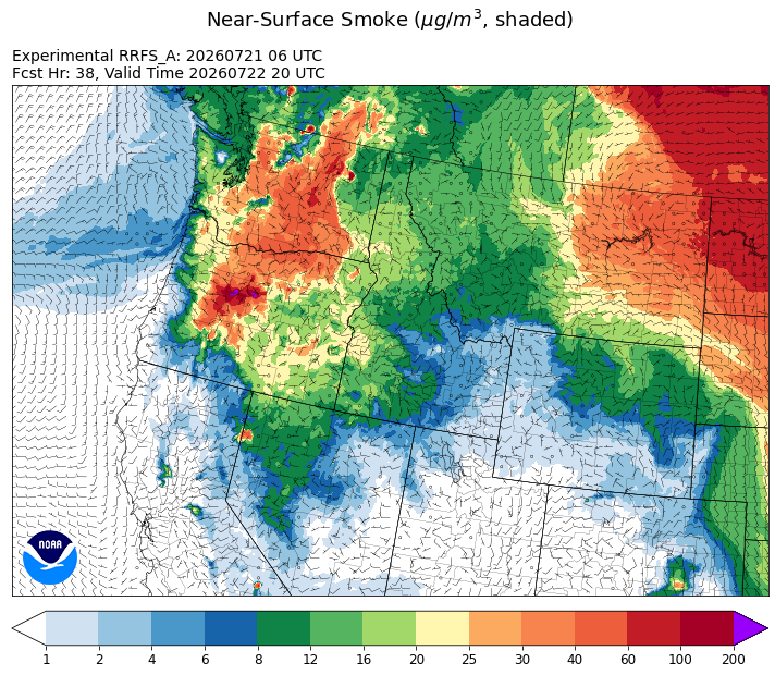
Source: HRRR-smoke
Forecast
Wildfire growth across Washington and Oregon has been impressive of late. Some of the smoke from these fires is being transported into the Treasure State. However, much of the smoke from these blazes remains aloft over Montana, and we aren’t seeing any significant reductions to air quality to the monitors close to the surface.
Monsoonal moisture will continue to stream north into the state through early Thursday. This will drag anomalously moist air into the Treasure State. It will also kick off scattered showers and thunderstorms each afternoon and evening. The precipitation that falls will be beneficial for the landscape. However, any lightning from these storms has the potential to spark new fires as fuel moistures in much of the state are trending in the wrong direction.
Critical fire weather conditions return to the state Friday and into the weekend. Warm, dry, and windy weather will elevate fire danger across the state. Afternoon high temperatures in the 90s will be accompanied by gusty afternoon winds and low humidities. Despite a slow start to wildfire season over Montana, wildfire activity could perk up in response to this pattern shift. Stay tuned!
Conditions can change quickly as weather could stimulate active fires and the likelihood of new starts increases. Please keep track of concentrations at todaysair.mtdeq.us or the Fire and Smoke Map.
Smoke from Oregon and Washington wildfires continues to stream into Montana early Tuesday morning.
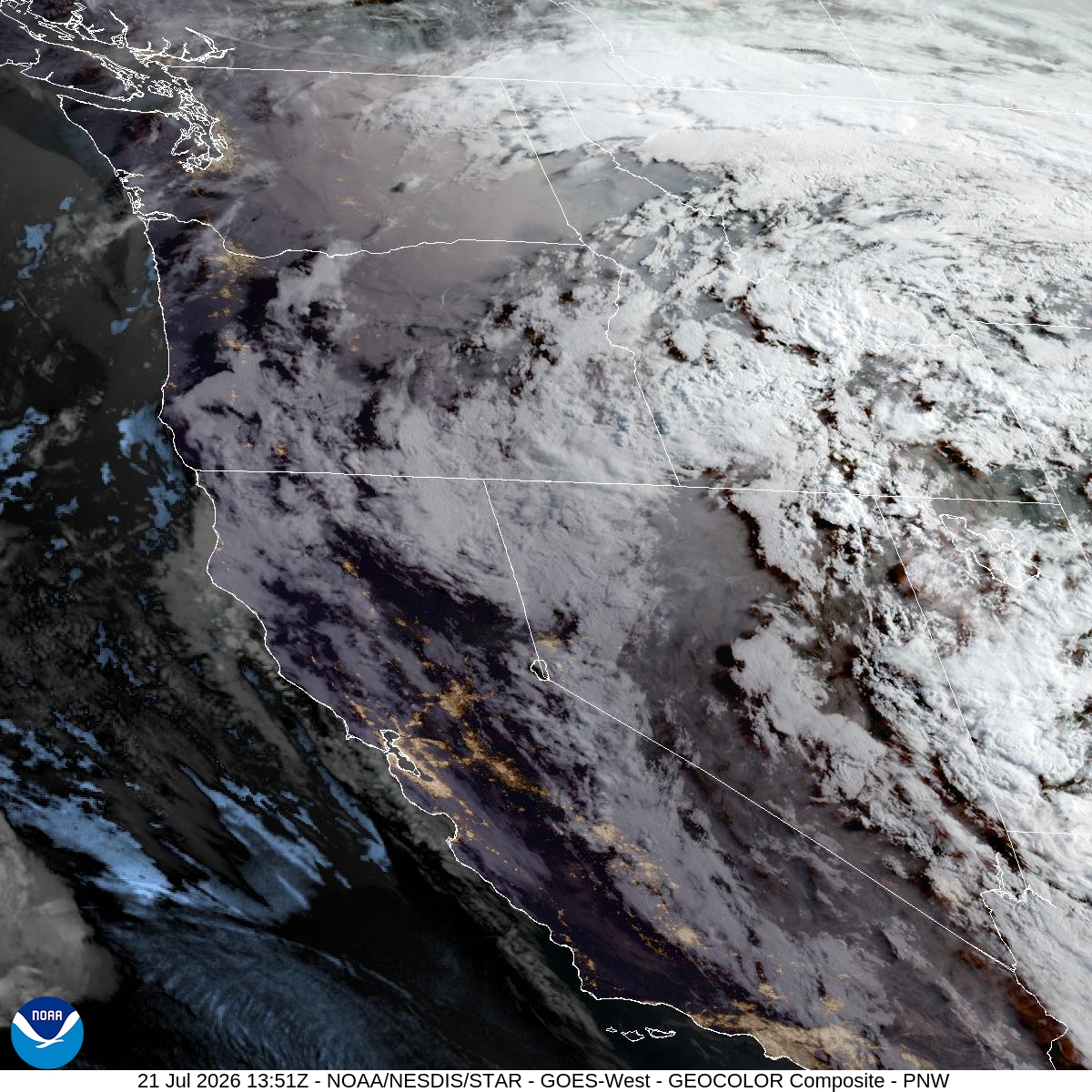
Source: NOAA
| Incident Name | State | Location | Acres | Containment |
|---|---|---|---|---|
| Upper Smith Fire | Idaho | Approx 20 miles northwest of Bonners Ferry, ID, up the Smith Creek Drainage | 815 | 0% |
| Claremont Fire | Idaho | 1 mile NE of Boise, Idaho | 6817 | 85% |
| Turner Fire | Idaho | 5 miles south of Copeland, Idaho | 681 | 66% |
| Shingle Creek | Idaho | Six Miles Southwest of Riggins, ID | 628 | 85% |
| Henry Fire | Oregon | 5 Miles S of PAULINA GUARD STATION, OR | 14335 | 10% |
| Hay Creek Complex | Oregon | Gilliam County and Sherman County, Oregon | 112698 | 20% |
| Akawa Butte Fire | Oregon | 13 Miles NE of Sisters, OR | 10326 | 3% |
| Rowe Creek Complex | Oregon | 10 Miles S of Fossil, OR | 142936 | 0% |
| Powder River Fire | Oregon | 4 Miles SW of RICHLAND, OR | 20727 | 10% |
| East Evans Creek Fire | Oregon | 14 Miles NE of Rogue River | 15015 | 8% |
| Burnt Creek Fire | Oregon | 23 Miles N of Enterprise, OR | 1650 | 0% |
| Anthony Fire | Oregon | 34 miles north of Baker City, OR | 2333 | 20% |
| Coyote Fire | Oregon | 5 miles south of Post, OR | 21000 | 0% |
| Salmon Fire | Oregon | 34 Miles SW of Baker City, OR | 1441 | 30% |
| Bologna Fire | Oregon | 7 miles northeast of Kimberly, OR | 2600 | 0% |
| Horse Ridge Fire | Oregon | NA | 557 | 10% |
| Egypt Fire | Oregon | 12 Miles N of Riley, OR | 4685 | 18% |
| Brewer Fire | Oregon | 15 Miles E of Madras, OR | 13854 | 0% |
| Pilot Fire | Oregon | 7 Miles NW of Post, OR | 120 | 20% |
| Hagen Fire | Oregon | NA | 1183 | NA |
| Paradise Fire | Oregon | 15 miles south of Pendleton Oregon | 453 | NA |
| North Cayuse Fire | Oregon | 15 miles east of Pendleton, OR. | 4887 | 91% |
| Little Giant Fire | Washington | 30 miles NW of Leavenworth, WA | 400 | 0% |
| Modrite Fire | Washington | 17 Miles SW of Inchelium, WA | 7702 | 0% |
| Kaiser Canyon Fire | Washington | Nespelem Okanogan / Kaiser Canyon | 62873 | 0% |
| Lyons Ferry | Washington | 16 miles E of Kahlotus WA | 34166 | 28% |
| Neff Jones | Washington | 17 miles south of Kahlotus | 7123 | 88% |
| Devils Canyon | Washington | 4 miles south of Kahlotus, WA | 4747 | 95% |
| Royal Lake | Washington | 8 miles NW of Othello, WA | 2037 | 68% |
| Wallace Walker Fire | Washington | 5 Miles SW of Kahlotus, WA | 798 | 90% |
| Mount Tom Creek Fire | Washington | Olympic National Park | 69 | 27% |
| B and O | Washington | 23200 Block of State Route 20, Okanogan, Washington | 2762 | 95% |
| Chelan Hills | Washington | NA | 9861 | 95% |
Tags: smoke forecast