
Smoke Forecast for Monday, July 20 2025 9:30 AM
Current Conditions
Wildfire activity across Oregon and Washington picked up over the weekend. Montana will continue to see air quality impacts from these blazes in the coming days.
At 8:00 AM Monday, air quality was moderate over Hamilton, Frenchtown, Lewistown, Billings, Bozeman, Columbia Falls, and Malta.
By Tuesday afternoon, the Rapid Refresh Forecast System (RRFS) smoke model shows moderate to heavy surface smoke covering northeast Montana from Canadian wildfires with light smoke covering the rest of the state from Idaho and Washington wildfires.
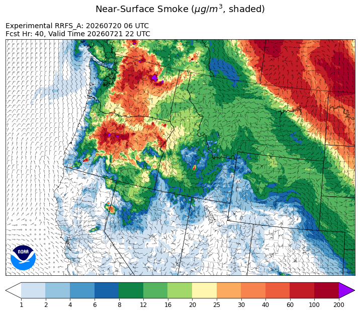
Source: HRRR-smoke
Forecast
Numerous wildfires burning over Washington and Oregon expanded over the weekend. Smoke from these blazes will stream into the state again on Monday. This smoke will degrade air quality and reduce visibility to start the week. Monsoonal moisture surges back into the state on Monday, bringing scattered afternoon thunderstorms and higher humidity levels.
Not only will the region contend with domestic smoke this week, but Canadian wildfire smoke will sag south of the border Monday and Tuesday. A weak cold front will transport a band of Canadian wildfire smoke through Tuesday, with impacts expected to the eastern third of Montana. However, looking at air quality monitors across Alberta and Saskatchewan early Monday morning, dangerous air quality isn’t expected from this event.
Looking ahead to the end of the week, a ridge of high pressure is expected to build back over the Treasure State. This will provide anomalously warm temperatures for Montana with triple digit heat possible Friday and into the weekend. The combination of warm temperatures, low humidity, and gusty winds will create dangerous fire weather conditions across Montana. Despite a slow start to the wildfire season in Montana, this could set the stage for a smokey end to July. Stay tuned!
Conditions can change quickly as weather could stimulate active fires and the likelihood of new starts increases. Please keep track of concentrations at todaysair.mtdeq.us or the Fire and Smoke Map.
Smoke from Oregon and Washington wildfires continues to stream into Montana early Monday morning.
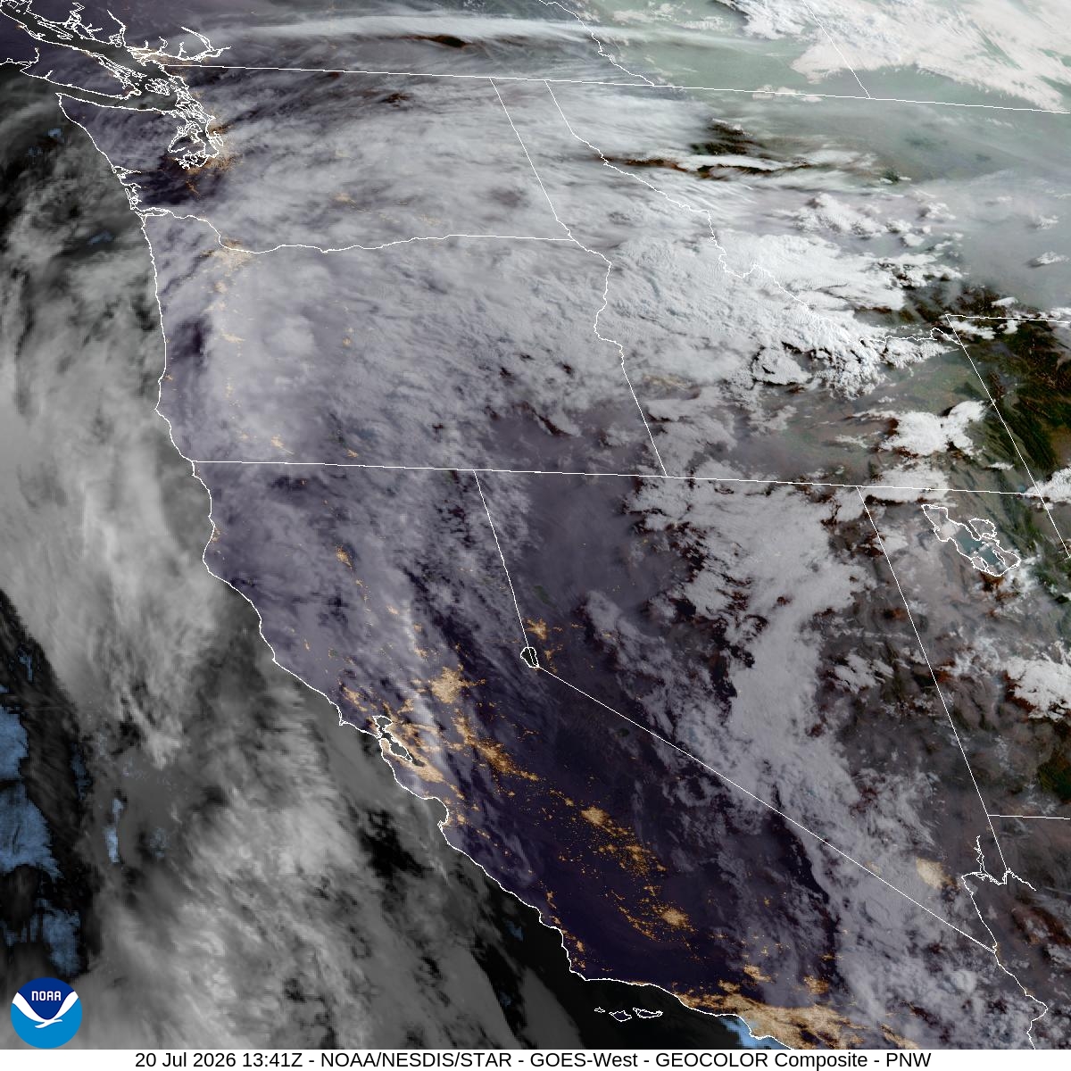
Source: NOAA
| Incident Name | State | Location | Acres | Containment |
|---|---|---|---|---|
| East Evans Creek Fire | Oregon | 14 Miles NE of Rogue River | 15015 | 8% |
| Hay Creek Complex | Oregon | Gilliam County and Sherman County, Oregon | 92211 | 27% |
| Anthony Fire | Oregon | 34 miles north of Baker City, OR | 1983 | 20% |
| Akawa Butte Fire | Oregon | 13 Miles NE of Sisters, OR | 6856 | 3% |
| Pilot Fire | Oregon | 7 Miles NW of Post, OR | 120 | 20% |
| Brewer Fire | Oregon | 15 Miles E of Madras, OR | 13854 | 0% |
| Horse Ridge Fire | Oregon | NA | 380 | NA |
| Paradise Fire | Oregon | NA | 377 | NA |
| Hagen Fire | Oregon | NA | 1183 | NA |
| North Cayuse Fire | Oregon | 15 miles east of Pendleton, OR. | 4887 | 91% |
| Neff Jones - WASES | Washington | 17 miles south of Kahlotus | 7123 | 88% |
| Devils Canyon | Washington | 4 miles south of Kahlotus, WA | 4747 | 95% |
| Lyons Ferry | Washington | 16 miles E of Kahlotus WA | 34166 | 28% |
| Kaiser Canyon Fire | Washington | Nespelem Okanogan / Kaiser Canyon | 60226 | 0% |
| Royal Lake | Washington | 8 miles NW of Othello, WA | 2037 | 68% |
| Modrite Fire | Washington | 17 Miles SW of Inchelium, WA | 6405 | 0% |
| Wallace Walker Fire | Washington | 5 Miles SW of Kahlotus, WA | 798 | 90% |
| Mount Tom Creek Fire | Washington | Olympic National Park | 69 | 27% |
| B and O Fire | Washington | 23200 Block of State Route 20, Okanogan, Washington | 2762 | 95% |
| Chelan Hills | Washington | NA | 9861 | 95% |
Tags: smoke forecast