
Smoke Forecast for Friday, July 17 2026 11:30 AM
Current Conditions
Dozens of new wildfire starts were ignited across Washington, Oregon, and Idaho over the last 48-hours.
At 11:00 AM Friday, air quality was moderate over Thompson Falls, Great Falls, and Malta.
By Saturday afternoon, the Rapid Refresh Forecast System (RRFS) smoke model shows moderate to heavy surface smoke covering northwest Montana from regional wildfires.
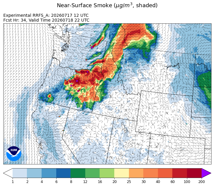
Source: HRRR-smoke
Forecast
Monsoonal moisture will continue to stream north into the northern Rockies over the next several days, providing opportunities for beneficial rainfall for Montana. Widespread thunderstorm activity earlier in the week sparked numerous wildfires across Washington, Oregon, and Idaho. These fires will expand in the coming days. Westerly transport winds will send some of this smoke into northwest Montana on Saturday. Air quality will be negatively impacted from these plumes. Thankfully, transport winds should weaken on Sunday, keeping much of the smoke outside of Montana.
A southerly flow will continue to pump anomalously moist air into the state over the next week or so. This will provide daily chances for showers and thunderstorms. Precipitation will help keep fuel moistures in check. However, lightning will accompany this moisture and new fire starts are possible under this regime.
Conditions can change quickly as weather could stimulate active fires and the likelihood of new starts increases. Please keep track of concentrations at todaysair.mtdeq.us or the Fire and Smoke Map.
Friday morning's satellite imagery shows surface smoke over Oregon, Washington, and northern Idaho. Some of this smoke is expected to impact northwest Montana on Saturday.
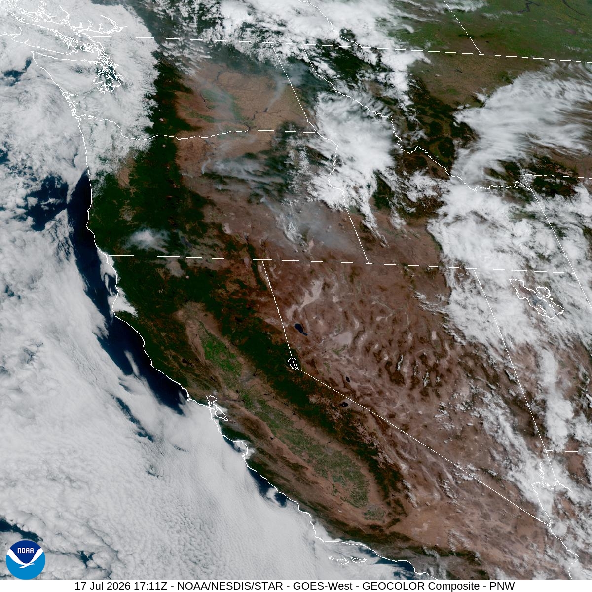
Source: NOAA
Tags: smoke forecast