
Smoke Forecast for Wednesday, July 17, 2024 9:00 AM
Current Conditions
A strong area of high pressure will continue to pump unseasonably warm air into Montana, fueling wildfire growth. The Horse Gulch fire just outside of Helena added some acreage on Tuesday, particularly on the northeast side of the fire. The Miller Peak fire south of Missoula has now burned close to 2,000 acres after starting just days ago. An Air Resource Advisor has been assigned to this fire, and will be providing detailed updates on the fire’s progress.
See the latest Air Resource Advisor report from the Horse Gulch fire here
At 8:00 AM Wednesday, Libby, Columbia Falls, Thompson Falls, Seeley Lake, Frenchtown, Missoula, Hamilton, Butte, Dillon, West Yellowstone, Great Falls, Broadus, and Sidney were enduring Moderate air quality.
Wednesday morning’s satellite reveals areas of smoke surging into Montana from numerous regional wildfires.
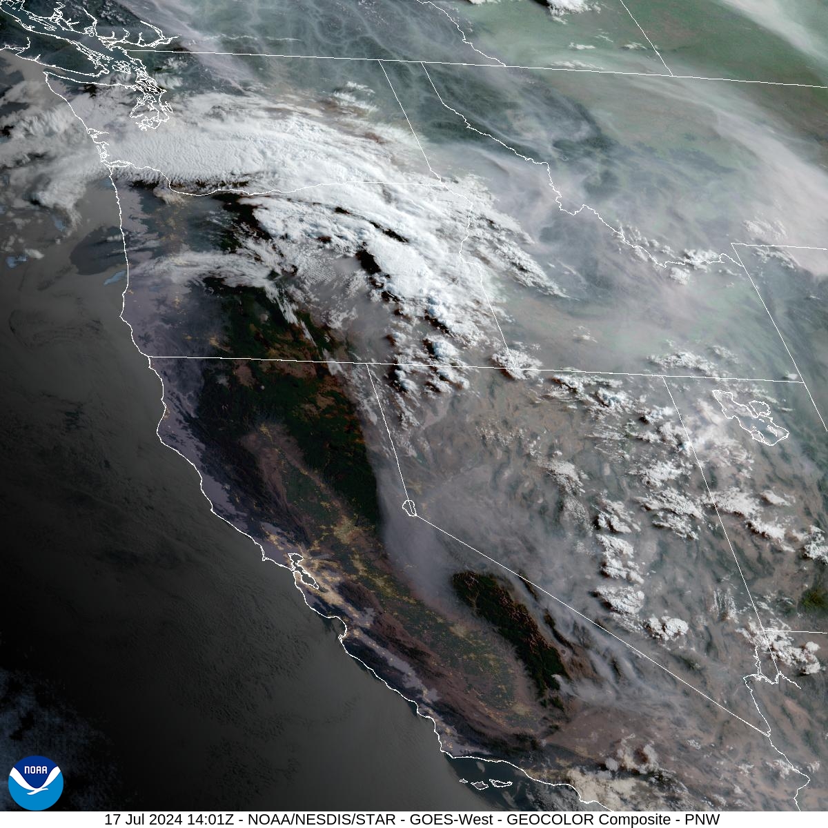
Source: NOAA
Forecast
A strong ridge of high pressure will remain in place through Friday. It will continue to produce unseasonably warm air, low relative humidity, and light winds. Existing wildfires will experience some growth because of these conditions. Because of light surface winds, some pooling and draining of the smoke can be expected, particularly in communities adjacent to large wildfires. Light easterly surface winds through Wednesday night will send plumes of smoke into the Helena Valley from the Horse Gulch fire, leading to compromised air quality.
A weak system will drift east into Montana Wednesday night and Thursday. It will provide widely scattered thunderstorms, primarily for the mountains. However, with humidity values in the teens, there is a very serious threat for dry lightning from this system. Considering how dry fuels are across the state, new fire starts are a real possibility. Any storm that does form will generate strong winds, leading to erratic fire behavior on existing blazes.
There is very little relief on the way through at least next Wednesday. Unseasonably warm air, low humidity, and a lack of widespread rain will lead to additional growth on existing wildfires. As winds ease in the evenings, wildfire smoke tends to pool into the valleys, leading to deteriorating air quality.
By Thursday morning, the HRRR-Smoke model shows medium to heavy smoke impacting Southwest Montana from the Miller Peak fire and other regional blazes.
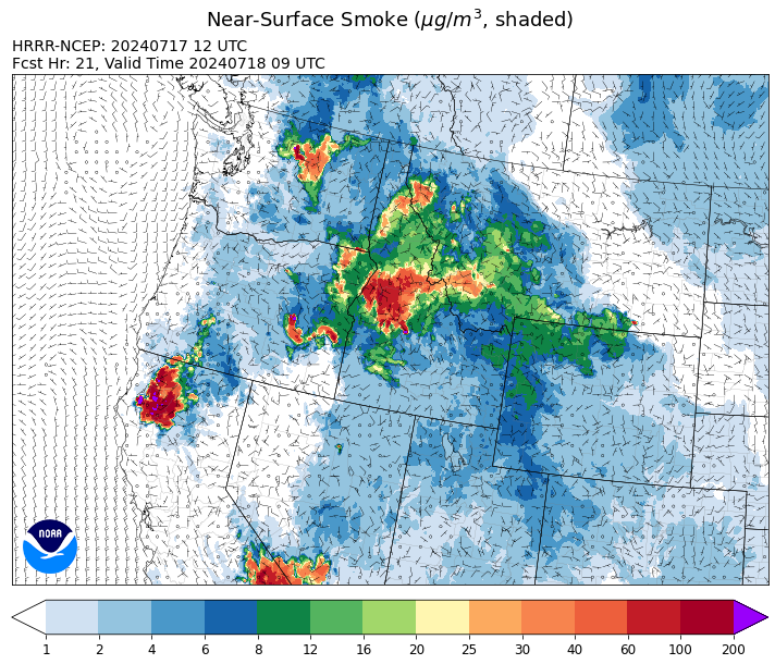
Source: HRRR Smoke
Conditions can change quickly as weather could stimulate active fires and the likelihood of new starts increases. Please keep track of concentrations at todaysair.mtdeq.us or the Fire and Smoke Map.
Current Wildfires
|
Incident |
State |
location |
acres |
containment |
|
Bench Lake Fire - IDSTF |
Idaho |
8 miles south of Stanley, Idaho |
1,850 |
3% |
|
Billy Creek Fire - IDIDS |
Idaho |
14.71 Miles SSE of Asotin, WA |
3,185 |
74% |
|
Miller Peak Fire - MTLNF |
Montana |
8 miles southeast of Missoula |
1,760 |
NA |
|
Horse Gulch Fire - MTHLF |
Montana |
5 miles south of York |
13,442 |
23% |
|
Deadman Fire - MTMTS |
Montana |
Approx 17 mi south of Birney and north of the Tongue River Reservoir in Rosebud and Big Horn Counties |
31,104 |
0% |
|
Falls Fire - ORMAF |
Oregon |
20 miles NW of Burns |
91,269 |
0% |
|
Salt Creek - OR710S |
Oregon |
5 miles SSW of Butte Falls, Oregon |
4,102 |
84% |
|
Cow Valley Fire - ORVAD |
Oregon |
9 miles east of Ironside, Ore. |
133,408 |
20% |
|
Larch Creek Fire - OR95S |
Oregon |
Friend, OR, a rural community |
18,690 |
27% |
|
Lone Rock Fire - ORPRD |
Oregon |
10 miles southeast of Condon, OR |
71,000 |
10% |
|
Pioneer - WASES |
Washington |
10 miles southeast of Stehekin, WA |
20,348 |
14% |
Source: Inciweb
Tags: Smoke Forecast 2024