
Smoke Forecast for Tuesday, July 8, 2025 9:30 AM
Current Conditions
High pressure is producing another unseasonably warm day across the state. Westerly transport winds continue to funnel light surface smoke into Montana from regional wildfires.
The Pomas Fire and the Apple Acres Fire burning in the western Washington Cascades continue to exhibit active fire behavior. The Apple Acres fire is up to 3,245 acres, while the Pomas Fire has burned 2,379 acres. The Sunrise fire east of Bend, Oregon grew significantly on Monday. It is now up to 450 acres. In Montana, the most active wildfire on Monday was the Magnum fire, burning just northwest of Billings. These regional wildfires combined with the unusually warm temperatures will contribute to an uptick in surface smoke around Montana on Tuesday.
At 9:00 AM Tuesday, Libby's air quality is Moderate.
The HRRR smoke model shows some surface smoke moving into Western Montana by Wednesday afternoon from numerous regional wildfires.
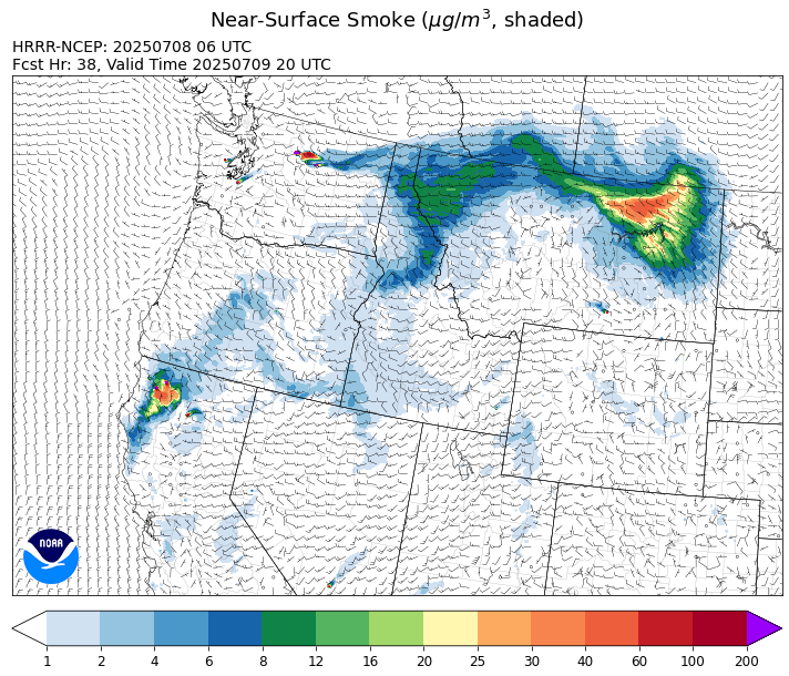
Source: HRRR-smoke
Forecast
High pressure will peak across Montana on Tuesday, producing one of the warmest days of the summer thus far. Breezy winds will develop by Tuesday afternoon and the combination of the heat and the wind will lead to another day of active fire behavior on regional wildfires. A westerly flow aloft will continue to transport surface smoke into the state from wildfires burning over Washington, Oregon, and California.
Moisture increases Tuesday night and Wednesday across the state. Showers and thunderstorms will develop across the region by Wednesday afternoon. There will continue to be elevated fire weather concerns due to strong winds, dry fuels, and unseasonably warm temperatures.
Cooler weather is expected by Thursday as a trough sags south out of Canada. Much of the region will see at least some light precipitation from this system. However, the northwest part of the state has the best chance of seeing a wetting rain from this scenario. The precipitation and cooler weather should help ease fire weather concerns, at least temporarily.
Conditions can change quickly as weather could stimulate active fires and the likelihood of new starts increases. Please keep track of concentrations at todaysair.mtdeq.us or the Fire and Smoke Map.
Tuesday morning’s satellite shows some smoke drifting across northern Idaho from wildfires burning across Washington.
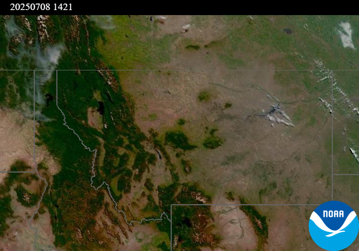
Source: NOAA
Tags: Smoke Forecast 2025