
Smoke Forecast for Monday, July 7, 2025 9:30 AM
Current Conditions
High pressure is gradually building over the Northern Rockies to start the week. The warm and dry conditions will lead to active fire behavior and increasing surface smoke around the region.
The Pomas Fire and the Apple Acres Fire burning in the western Washington Cascades exhibited active fire behavior over the weekend. The Apple Acres fire is up to 3,242 acres, while the Pomas Fire has burned 2,379 acres. The Cold Springs Fire burning just northeast of Hermiston, Oregon has grown considerably of late. It is up to 2,986 acres. Additionally, there are numerous active fires burning over northern California around Mt. Shasta. These regional wildfires combined with the unusually warm temperatures will contribute to an uptick in surface smoke around Montana in the coming days.
At 9:00 AM Monday, Great Falls’ air quality is Moderate.
The HRRR smoke model shows some light surface smoke moving into Western Montana by late Tuesday night from numerous regional wildfires.
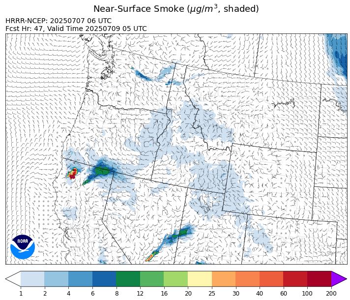
Source: HRRR-smoke
Forecast
High pressure will build across the region between Monday and Tuesday. It will produce afternoon high temperatures that will climb well into the 90s in most valley locations. There are numerous active fires burning across Washington, Oregon, and northern California. This dry and warm weather pattern will lead to an uptick in fire behavior, while generating additional smoke over the region and Western Montana.
Wednesday will bring some subtle changes to our weather, as a trough enters the state. It will produce strong southwesterly winds and a few scattered storms. The combination of lightning, dry fuels, and gusty winds could bring new fire starts to the area.
On Thursday, an area of low pressure moves into the region. Forecast models have been trending up in terms of precipitation amounts. There looks to be a good decent chance that most of the state will see a wetting rain from the event (at least a tenth of an inch of precipitation). High pressure and a warmer, drier pattern will likely return by the weekend. Stay tuned!
Conditions can change quickly as weather could stimulate active fires and the likelihood of new starts increases. Please keep track of concentrations at todaysair.mtdeq.us or the Fire and Smoke Map.
Monday morning’s satellite shows a departing trough and clouds over the eastern half of the state, while Western Montana enjoys mainly clear skies.
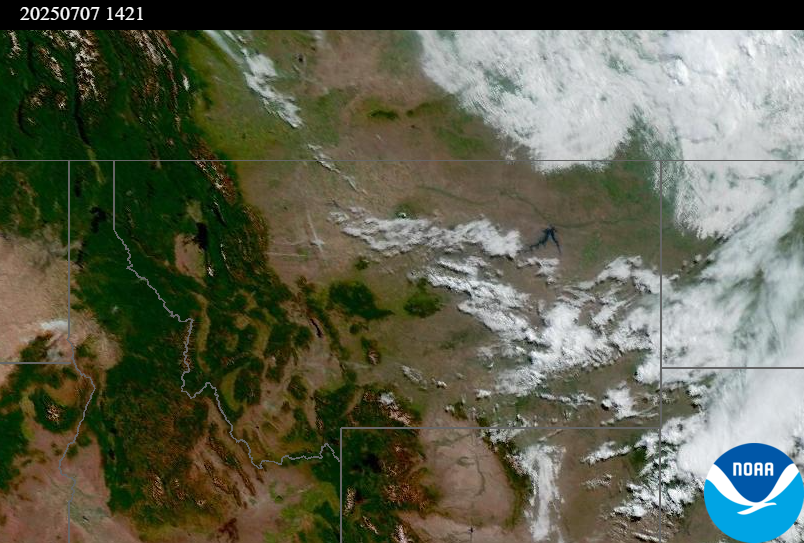
Source: NOAA
Tags: Smoke Forecast 2025