
Smoke Forecast for Thursday, July 3, 2025 9:30 AM
Current Conditions
Another trough moves into the region on Thursday. However, warmer than normal temperatures and gusty winds will bring another day of active fire behavior to Pacific Northwest wildfires.
Firefighters have made good progress this week on the Jericho Mountain Fire southwest of Helena. There is still a lot of dead and downed trees surrounding the blaze, complicating containment efforts. Despite the recent warm stretch of weather, 95% of the fire is now contained. The Pomas Fire in the western Washington Cascades exhibited active fire behavior again on Wednesday. The blaze has grown to 1,910 acres. The Cold Springs Fire burning just northeast of Hermiston, Oregon has grown to 1,000 acres. Both blazes will continue to send smoke into Idaho and Montana in the coming days.
At 9:00 AM Thursday, Bozeman, Billings, and Great Falls’ air quality are Moderate.
The HRRR smoke model shows some light surface smoke moving into Northwest Montana by late Friday night from the Pomas Fire burning in Washington and the Cold Springs Fire in Oregon.
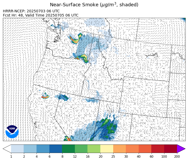
Source: HRRR-smoke
Forecast
Another trough swings across the state on Thursday. It will produce a round of afternoon showers and thunderstorms. Some of the stronger storms will contain gusty winds, small hail, and frequent lightning. Fuel moistures are very dry for early July and Wednesday’s storms did start a few wildfires across the state. There is a concern that we could see the same thing happen again Thursday afternoon and evening.
Another stronger system moves across the Treasure State between Friday and Saturday. It should provide the best opportunity for a widespread wetting rainfall for the area. This system should help to moderate wildfire behavior on many of the new starts across the state. It should also limit smoke production on these fires. Much of the higher terrain around western Montana will see at least a half an inch of rain between Friday and Saturday.
Most long-range models are advertising a strong ridge of high pressure building over the Northern Rockies starting on Monday. This ridge will bring a long, dry, and hot stretch of weather to the region, lasting through the end of the week. The weather pattern will likely produce more active fire weather on existing wildfires and increased surface smoke production. Stay tuned!
Conditions can change quickly as weather could stimulate active fires and the likelihood of new starts increases. Please keep track of concentrations at todaysair.mtdeq.us or the Fire and Smoke Map.
The DNRC fire map shows numerous new fires in the last 24-hours (in yellow) from recent thunderstorm activity.
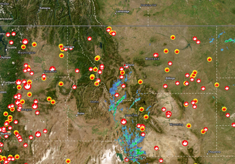
Source: DNRC
Tags: Smoke Forecast 2025