
Smoke Forecast for Wednesday, July 2, 2025 10:00 AM
Current Conditions
Unseasonably warm temperatures and gusty winds will lead to another day of active fire behavior on existing wildfires across the Pacific Northwest again on Wednesday.
Firefighters have done yeoman’s work on the 482-acre Jericho Mountain Fire southwest of Helena. There is still a lot of dead and downed trees surrounding the blaze, complicating containment efforts. Despite the recent warm stretch of weather, 95% of the fire is now contained. The Pomas Fire in the western Washington Cascades exhibited active fire behavior again on Tuesday. The blaze has grown to 1,759 acres. It will continue to send smoke into Idaho and Montana in the coming days.
At 9:00 AM Wednesday, Libby, Butte, and Great Falls' air quality are Moderate.
The HRRR smoke model shows some surface smoke moving into Northwest Montana Thursday morning from the Pomas Fire burning in Washington.
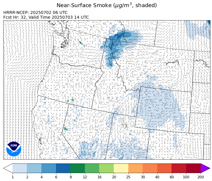
Source: HRRR-smoke
Forecast
A trough will swing across the Treasure State on Wednesday. A southerly flow will send temperatures climbing well into the upper 80s and 90s. This will likely produce another day of active fire behavior on the Pomas Fire in Washington. Smoke models are indicating that some surface smoke from this fire will drift into portions of northern Idaho and Montana by Thursday and Friday.
A series of storms will impact Montana between Wednesday and the weekend. Severe storms are possible by Wednesday afternoon, with a few of the stronger storms containing large hail and gusty winds. Lightning will accompany some of the storms and with soil moistures remaining drier than normal, new fire starts are certainly possible.
Long range models continue to highlight the potential for a long, dry, and hot stretch of weather starting next Wednesday. If this comes to fruition, we could see new fire starts and dramatic growth on existing wildfires across the state and around the region. Stay tuned!
Conditions can change quickly as weather could stimulate active fires and the likelihood of new starts increases. Please keep track of concentrations at todaysair.mtdeq.us or the Fire and Smoke Map.
Wednesday morning’s satellite image shows a trough moving into the Treasure State producing clouds across the western part of the state.
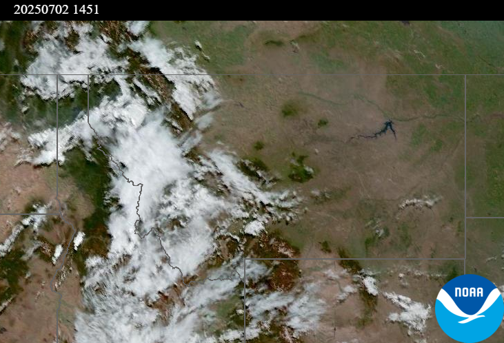
Source: NOAA
Tags: Smoke Forecast 2025