
Smoke Forecast for Tuesday, July 1, 2025 9:15 AM
Current Conditions
High pressure will provide another day with unseasonably warm conditions on Tuesday. The heat will help to further dry out fuels, producing more active fire behavior, particularly in the afternoon as highs climb into the 90s.
Firefighters continue to make progress on the 493-acre Jericho Mountain Fire southwest of Helena. There is still a lot of dead and downed trees surrounding the blaze, complicating containment efforts. 89% of the fire is now contained. Despite the warm temperatures to start the week, no significant fire spread is anticipated in the next 48-72 hours. The Pomas Fire in the western Washington Cascades exhibited active fire behavior late Monday. The blaze has grown to 1,633 acres. It will continue to send smoke into Idaho and Montana in the coming days.
At 9:00 AM Tuesday, Seeley Lake, Butte, and Sleeping Giant’s air quality are Moderate.
The HRRR smoke model shows light surface smoke moving into southern portions of the state by early Wednesday morning.
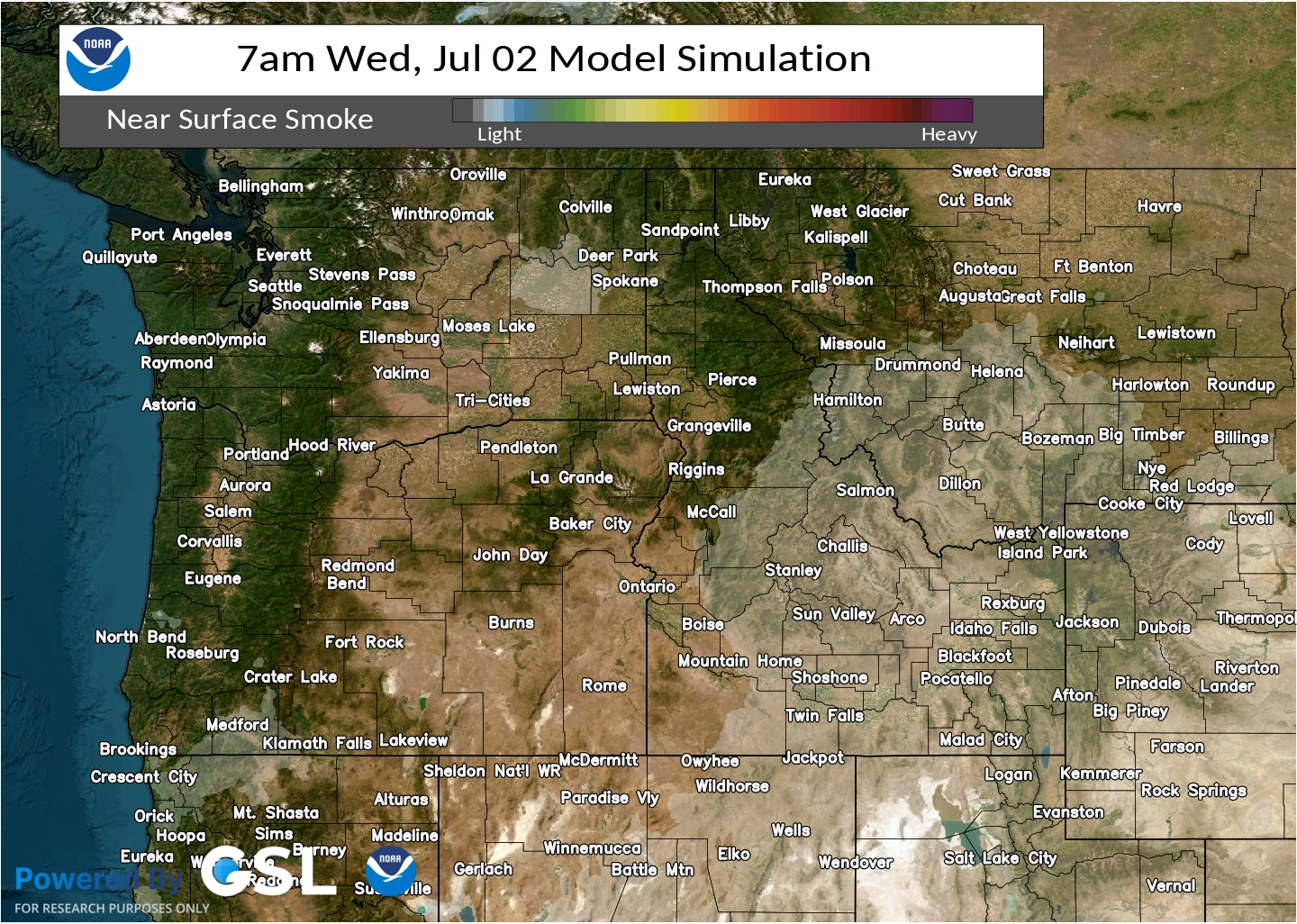
Source: HRRR-smoke
Forecast
High pressure builds over the Treasure State on Tuesday. It will result in one of the warmest afternoons of the summer thus far. The combination of the heat, low relative humidities, and dry fuels will lead to active fire behavior on wildfires across the Pacific Northwest and Northern Rockies. Dry and wet thunderstorms are possible Tuesday afternoon as a weak disturbance moves over the ridge. Wind gusts could approach 60 miles per hour with some of the stronger storms.
The ridge of high pressure starts to weaken and shift east on Wednesday. A southwesterly flow will funnel a moister and more unstable airmass into the state. A series of impulses will interact with this set-up, triggering thunderstorms by Wednesday afternoon and evening. Some of the stronger storms will contain gusty winds, hail, and torrential downpours.
A series of disturbances will march across the Treasure State by Thursday, Friday, and into the weekend. These should be efficient rain producers. The additional moisture should help to keep regional wildfires in check.
Conditions can change quickly as weather could stimulate active fires and the likelihood of new starts increases. Please keep track of concentrations at todaysair.mtdeq.us or the Fire and Smoke Map.
Tuesday morning’s satellite image shows clear skies and very little surface smoke over the state.
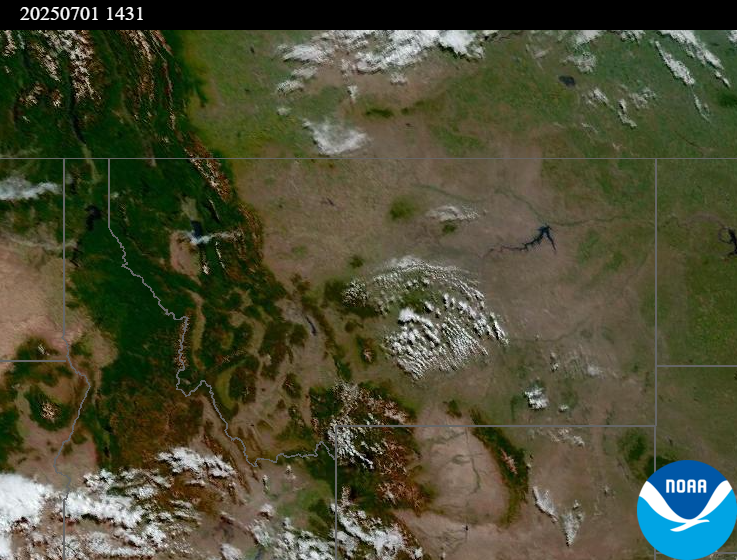
Source: NOAA
Tags: Smoke Forecast 2025