
Smoke Forecast for Monday, June 30, 2025 10:45 AM
Current Conditions
A sprawling ridge of high pressure will dominate the weather to start the week over Montana. It is providing abundant sunshine and unseasonably warm temperatures. Despite the ridge, air quality remains good across much of the Treasure State.
Thanks to recent precipitation, firefighters are beginning to get a better handle on the 493-acre Jericho Mountain Fire southwest of Helena. There is still a lot of dead and downed trees surrounding the blaze, complicating containment efforts. As of Monday morning’s update, 40% of the fire is contained. Despite warmer temperatures to start the week, no significant fire spread is anticipated in the next 48-72 hours.
At 10:00 AM Monday, Hamilton and Sleeping Giant’s air quality are Moderate.
The HRRR smoke model shows light surface smoke moving into southern portions of the state by early Wednesday morning.
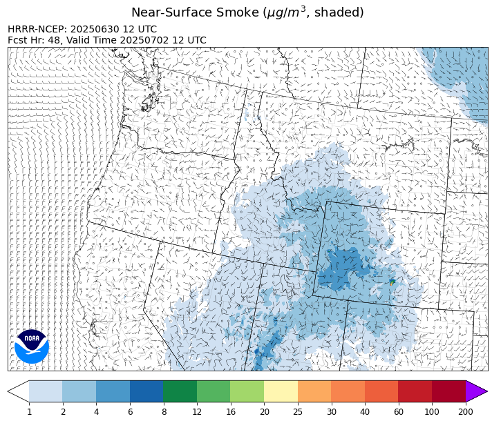
Source: HRRR-smoke
Forecast
A large ridge of high pressure will be the main weather story over the Northern Rockies to start the week. The unseasonably warm air associated with this feature will result in drying fuels and increased fire behavior on existing blazes. Highs will climb well into the 80s and 90s through Wednesday. Starting Tuesday, a southerly flow will produce some light concentrations of surface smoke over southern parts of the state from fires burning over the Desert Southwest.
The ridge moves east on Wednesday as a southwesterly flow returns. This is typically a strong signal that afternoon thunderstorms will return to the region. The pattern will provide daily chances for afternoon storms between Wednesday and the weekend. Across Montana, the best opportunities for precipitation should be from Thursday to Friday.
Conditions can change quickly as weather could stimulate active fires and the likelihood of new starts increases. Please keep track of concentrations at todaysair.mtdeq.us or the Fire and Smoke Map.
Monday morning’s satellite image shows clear skies and very little surface smoke over the state.
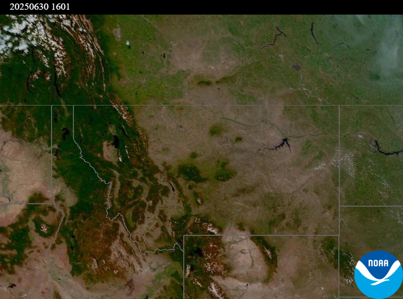
Source: NOAA
Summary
Unseasonably warm temperatures between Monday and Wednesday could lead to more active fire behavior on existing wildfires. A southerly flow will provide additional surface smoke from regional wildfires by late Tuesday or Wednesday.
Tags: Smoke Forecast 2025