
Smoke Forecast for Friday, May 30, 2025 1:00 PM
Current Conditions
Wildfires across western Canada have experienced dramatic growth over the past week. Many of these fires are overwintering blazes that reignited due to dry and unseasonably warm conditions. A broad ridge of high pressure over the Northern Rockies continues to funnel smoke into the Dakotas and the eastern edge of Montana.
At 12:00 PM Friday, Broadus, Sleeping Giant, and Great Falls’ air quality are Moderate.
The HRRR smoke model shows surface smoke from Canadian wildfires sagging south into the northeastern corner of Montana by Saturday afternoon.
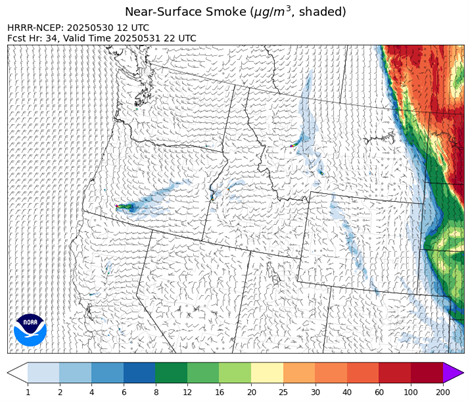
Source: HRRR-smoke
Forecast
A northerly flow will allow smoke from Canadian wildfires to sink south into the northeastern corner of Montana on Saturday. It’s not entirely clear how much of this smoke will be at the surface compared to aloft. However, visibility will likely be reduced at times on Saturday for places like Glasgow, Sidney, and Glendive. A trough approaches the region by Saturday night and Sunday. It should help to scour out the smoke as a westerly flow develops for the region. It will provide better air quality and improved visibility for the entire region by Sunday.
Conditions can change quickly as weather could stimulate active fires and the likelihood of new starts increases. Please keep track of concentrations at todaysair.mtdeq.us or the Fire and Smoke Map.
Canadian wildfire smoke rotating around an area of high pressure is visible Friday afternoon across the Dakotas and the eastern edge of Montana.
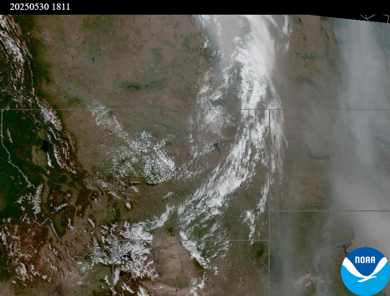
Source: NOAA
Summary
Air quality will gradually deteriorate on Saturday as Canadian wildfire smoke sags south into the eastern edge of Montana. An approaching trough should provide better air quality and less smoke Saturday night and Sunday.
Tags: Smoke Forecast 2025