
Smoke Forecast for Friday, July 12, 2024 8:00 AM
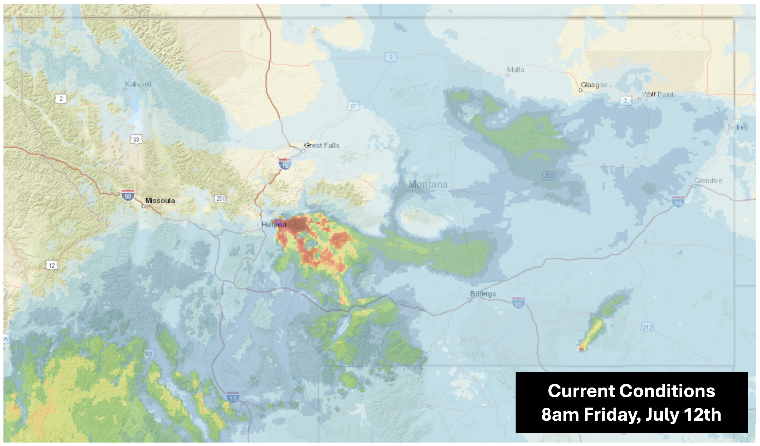
Current Conditions
Air quality has improved slightly from yesterday as transport winds have cleared some of the smoke across the state. Light smoke from wildfires in Washington and Oregon continue to affect air quality primarily in Northwest and Eastern Montana on Friday morning. The heaviest smoke impacts are between Helena and Bozeman; this smoke is largely due to the 10,000-acre Horse Gulch Fire that continues to burn near Canyon Ferry.
Though weakening, an atmospheric ridge has delivered another day of high temperatures and low relative humidity, so new fires remain a concern.
This morning, air quality for Libby, Flathead Valley, Frenchtown, Cut Bank, Helena, Bozeman, West Yellowstone, Lewistown, Malta, Miles City, and Broadus is moderate.
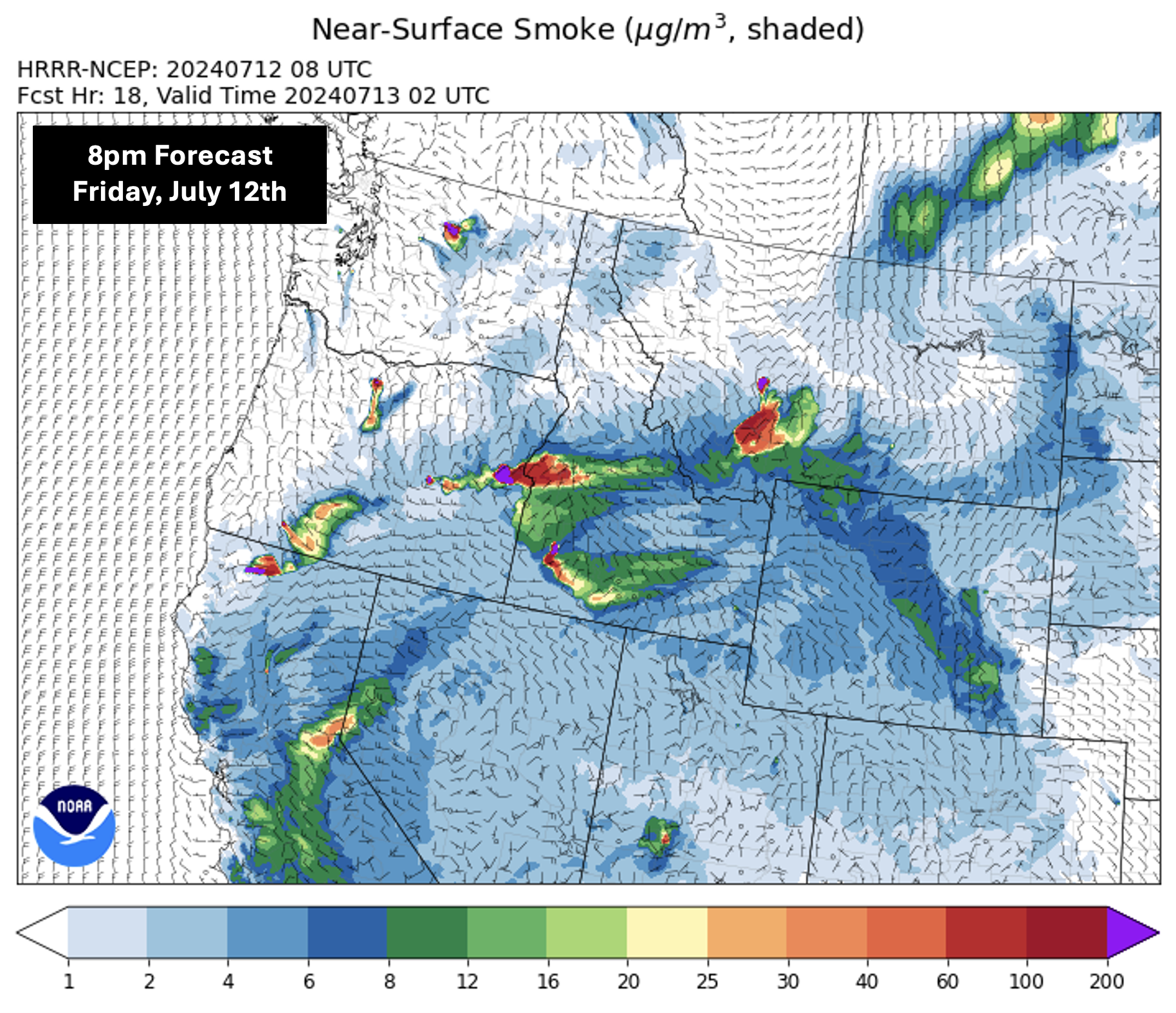
Forecast
Light smoke will persist across Southern Montana throughout Friday while slight westerly winds will push smoke from Washington into the far Northwest corner of the state. Beginning in the evening, northerly wind will draw light Canadian wildfire smoke back into Eastern Montana.
Due to the proximity of the Horse Gulch Fire to Helena and surrounding areas, slight shifts in wind can cause dramatic local variability in smoke concentrations and therefore air quality. The smoke plume will likely impact the area between Canyon Ferry, White Sulphur Springs, and Bozeman the most, but smoke density in East Helena may increase early Friday evening.
Looking into the weekend, expect widespread wildfire smoke to have the greatest impact on Southern Montana.
Temperatures will remain high today and into the weekend with daily highs in the 90s for much of the state. High temperatures and low relative humidity (<15%) will continue to contribute to potential fire risk in Montana and the rest of the West.
Conditions can change quickly as weather could stimulate active fires and the likelihood of new starts increases. Please keep track of concentrations at Today's Air or the Fire and Smoke Map.
Tags: Smoke Forecast 2024