
Smoke Forecast for Monday, June 29 2026 3:30 PM
Current Conditions
Wildfire activity across northern Saskatchewan and Alberta has picked up over the last several days.
At 3:00 PM Monday, air quality was good across all of Montana.
By Tuesday afternoon, the Rapid Refresh Forecast System (RRFS) smoke model shows moderate to heavy surface smoke covering the eastern half of Montana from Canadian wildfire smoke.
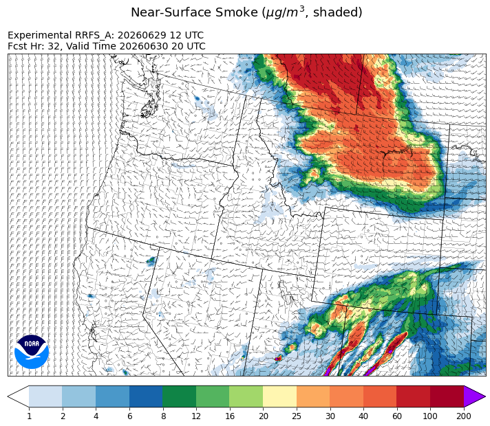
Source: HRRR-smoke
Forecast
Behind an exiting trough, upper-level winds shift to the northwest late Monday night and Tuesday. This will transport wildfire smoke from fires burning across northern Saskatchewan and Manitoba into the eastern half of Montana. Smoke models show surface smoke levels briefly reaching moderate or even unhealthy for sensitive groups levels on Tuesday over the eastern half of the state. However, the smoke intrusion looks to be short-lived, as upper-level winds are expected to shift to the southwest on Wednesday, cutting off Montana from Canadian smoke.
Thankfully, most of Montana has picked up beneficial rainfall over the last 48-hours. Between one and four inches of precipitation has fallen across the Treasure State, mitigating the risk for new fire starts and boosting fuel moisture. This will help reduce the risk for new wildfires across Montana for the next one to two weeks. Stay tuned!
Conditions can change quickly as weather could stimulate active fires and the likelihood of new starts increases. Please keep track of concentrations at todaysair.mtdeq.us or the Fire and Smoke Map.
Heavy surface smoke over northern Alberta and Saskatchewan is expected to be transported south into Montana Monday night and Tuesday.
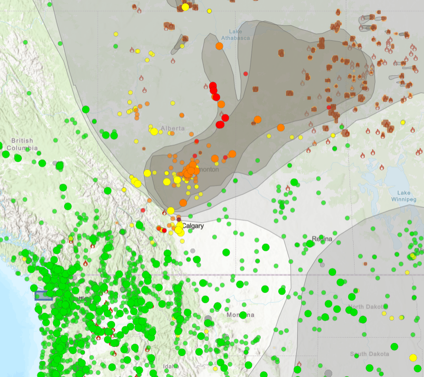
Source: AirNOW
Tags: smoke forecast